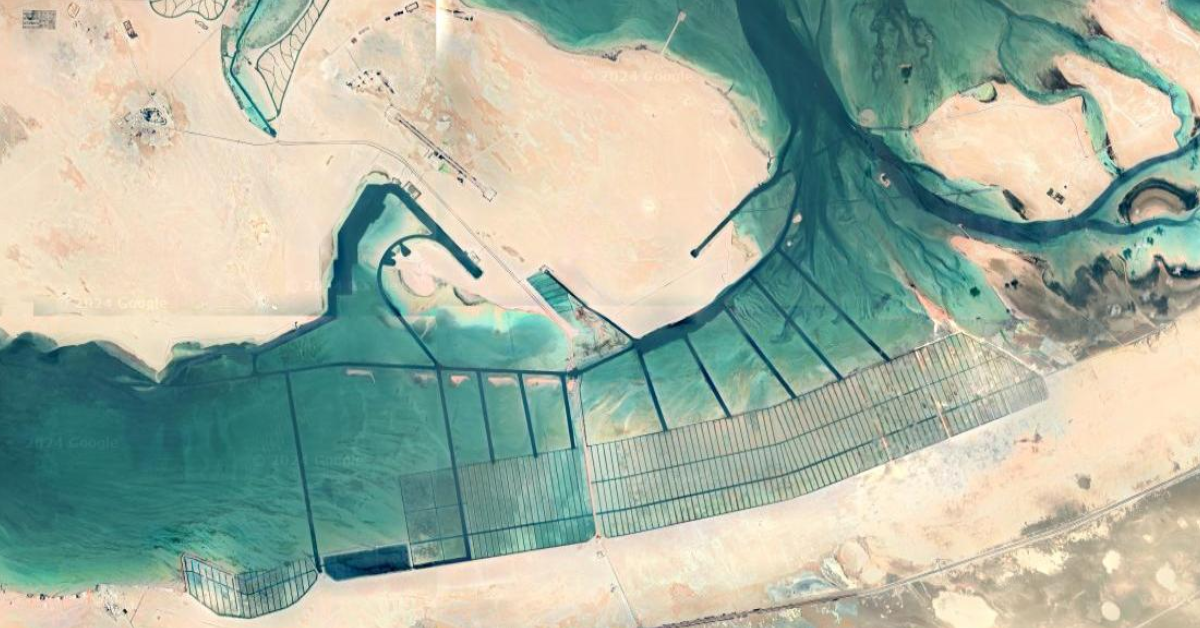
What are these elongated rectangles in the water area? ( lemmy.world )
Found on a google maps trip to Al Jirab, Along the E11
24°05'14.0"N 53°55'27.0"E
I found this while looking for interesting places to share on the Top View community here on Lemmy
https://lemmy.world/pictrs/image/0c45f423-03fa-477d-821b-c22f1f0cb308.png
After some more research, the most likely candidates:
mangrove nurseries, salt harvesting, algae farm, coral nurseries.
But nothing yet is confirmed!
https://lemmy.world/pictrs/image/6b5c2360-c083-4463-99de-3995cee64384.png
https://lemmy.world/pictrs/image/08b83e57-8007-4f77-b2ca-bcec48ec5ffa.png
https://lemmy.world/pictrs/image/62c02178-413c-449a-90e9-0cd010c6b239.png
https://lemmy.world/pictrs/image/ed5806a4-acf0-45a6-9fa3-10196f7c2844.png-----

